
EOSAT 4 Sustainable Amazon project
SarVision has implemented in 2020 and 2021 The EOSAT 4 Sustainable Amazon project’s goal is to support the Sustainable Development Goals (SDGs) in the Colombian Amazon. Advanced Earth Observation (EO) radar satellite technology (i.e., Sentinel 1, ALOS PALSAR) is used for near real-time monitoring, which is crucial for creating a response system suited to successfully address deforestation and forest degradation. The project was carried out in collaboration with various Colombian stakeholders; National institute for Amazonian research (SINCHI), National Park System, Territorial Amazonia (DTAM) and NGO’s like Fundación para la Conservacion y el Desarrollo Sostenible (FCDS), Fundación Gaia Amazonia (GAIA), Amazon Conservation Team (ACT) and Frankfurt Zoological Society (FZS).
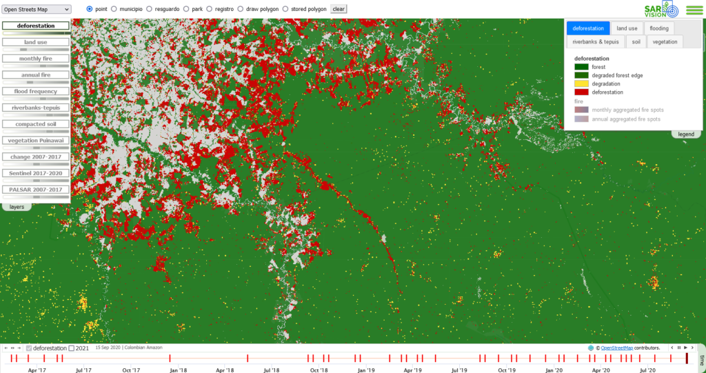
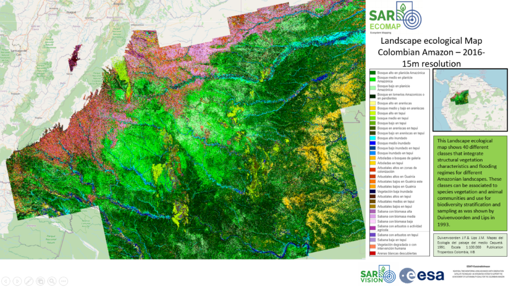
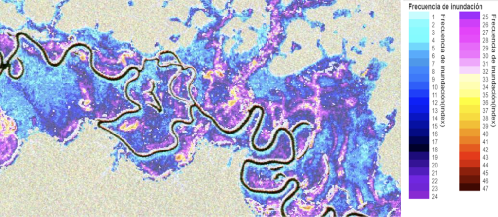
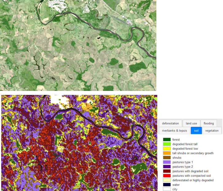
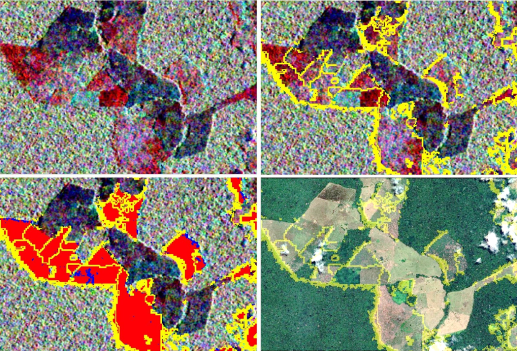
The project focused on the analysis of radar time series, for which in-house developed cutting-edge algorithms for baseline mapping (i.e., SarEcomap and SarSoil ) and time-series analysis (i.e., SarSentry and SarFlood) were used. Besides radar imagery, optical satellite data (i.e., Sentinel 2, MODIS and VIIRS) was employed in some of the analyses. Products developed in the frame of the project include: Near Real-Time monitoring for deforestation and degradation; flooding, flood frequency, soil degradation and high resolution ecosystem maps; deforestation and degradation historical change analyses; fire and river– and-island dynamics time-series analysis; and location of rock formations.
A monitoring system frame capable of responding to the information needs required to support the achievement of the SDGs in the Colombian Amazon was presented to the recipients of the project’s products. As an addition to the data communication aspect of the monitoring frame, a mobile App was developed to deliver deforestation information to local users in the Colombian Amazon.
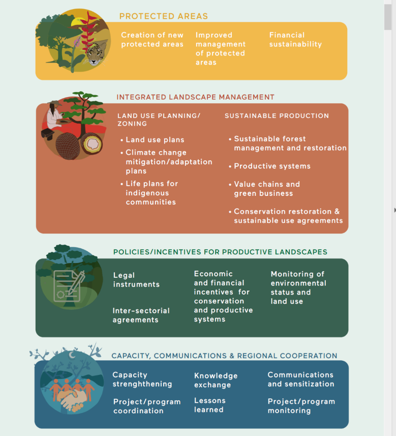
The project was rated by the stakeholders as a success. All developed products met the final users’ expectations and were considered as a major support for the attainment of the following SDGs in the region: 1) Creation of new protected areas; 2) Improved management of protected areas; 3) Support Land use plans and Life plans for indigenous communities; 4) Climate change monitoring; 5) Sustainable Forest management; 6) Land and forest restoration projects; 7) Support Productive systems and value chains for green business. In addition, communication in this project lead to an increased attention and sensitization of the current environmental crisis in the Colombian Amazon.