
Carbon
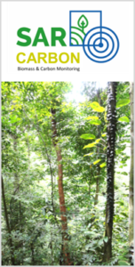
SarVision developed the SarCarbon system for accurate large scale biomass and carbon mapping. Multi sensor baseline maps, including GEDI lidar data are combined with SarSentry’s forest change maps to assess near real time biomass and carbon changes in forest areas. This new approach includes the significant contribution of forest degradation as part of the biomass. The SarCarbon system not only improves the accuracy of existing satellite based methods, it also allows to monitor carbon changes over time
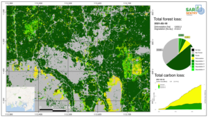
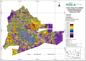
With the SarCarbon system first an accurate baseline biomass map is made. The accuracy of this map is much higher than the current remote sensing based biomass maps as multiple sensor information (optical & radar & laser) is combined with available field data. With the latest biomass conversion equations from Wageningen University and Research this map is converted into a detailed carbon baseline map. Forest change maps of the SarSentry system are used to automatically generate biomass and carbon change maps over time. For a simulation of forest and carbon change over time (2016- 2021) click on the image above (Total forest loss). For a factsheet on SarCarbon click here.